Welcome to our store!

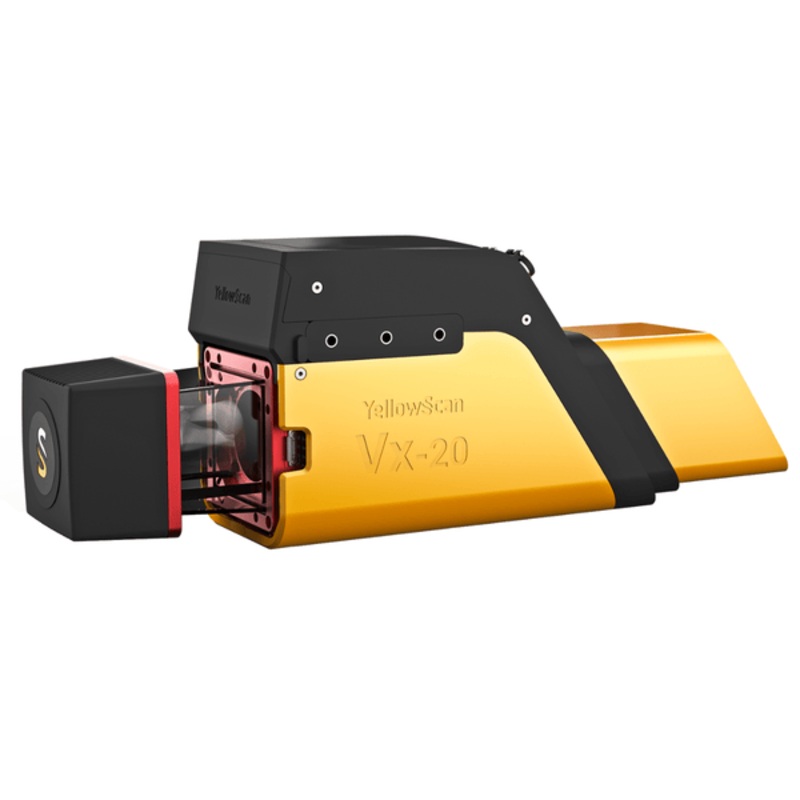
YellowScan Vx20-100 Integrated System | The Most Accurate, High Precision UAV LiDAR SolutionYellowScan Vx20-100is the most accurate fully integrated system from YellowScans product range. It can fly up to 100m while maintaining accuracy throughout the poin
YellowScan Vx20-100 Integrated System | The Most Accurate, High Precision UAV LiDAR Solution
YellowScan Vx20-100is the most accurate fully integrated system from YellowScans product range. It can fly up to 100m while maintaining accuracy throughout the point cloud. Ideally suited for high flight UAVprojects that require sharp, accurate descriptions.
Key Features:
Designed to Fit Any UAV
The Vx20-100’s light weight allows for easy mounting on a variety of UAVs: multirotor, fixed wing, or helicopter drones.
Highest Accuracy of the Vx Series
The YellowScan Vx20-100 has an accuracy of less than 2.5cm.
Fly Higher With the Vx20 Series
Up to 120m compared to 90m with the Vx15 series.
Increased Performance
In roll, pitch, and heading angles measurement.
Fit for a Wide Variety of Applications
Ideally suited for applications requiring sharp and accurate descriptions such as in civil engineering.
Data Generation in a Few Clicks
Handle pointclouds with YellowScan’s own, all-in-one software solution. Extract, process, and display data immediately after flight acquisition. Applanix POSPac UAV, to post-process GNSS and inertial data for highest accuracy. YellowScan CloudStation Essential to generate, visualize, inspect, and export data.
Advanced Calibration
All YellowScan systems are calibrated before shipment and come with a calibration certificate. Be ready to fly your system as soon as you receive it!
YellowScan – Designed to Innovate
Reviews
There are no reviews yet.