Welcome to our store!

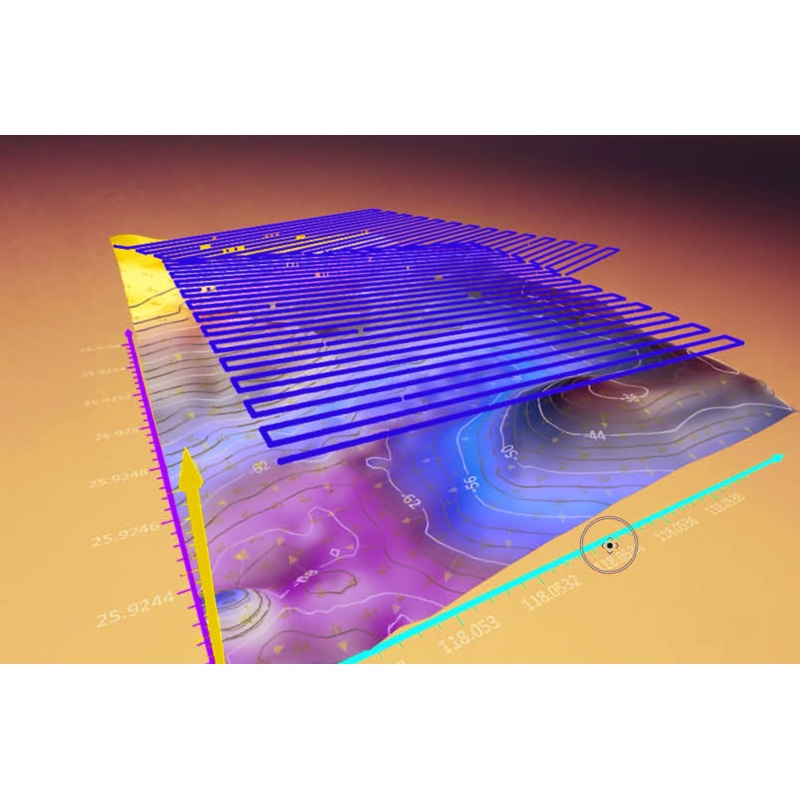
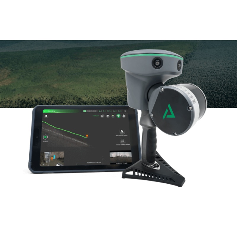
The QYSEA QY-BT is an advanced bathymetric tool designed for underwater mapping and data collection using QYSEA FIFISH AI ROVs. Integrated with the cutting-edge Q-DVL system, the QY-BT delivers stable maneuverability and precise depth measurements for seab
The QYSEA QY-BT is an advanced bathymetric tool designed for underwater mapping and data collection using QYSEA FIFISH AI ROVs. Integrated with the cutting-edge Q-DVL system, the QY-BT delivers stable maneuverability and precise depth measurements for seabed surveys. It allows users to:
Set automated paths for accurate seabed scanning
Capture depth data and generate 2D/3D maps, contour lines, and volume calculations
Apply customizable depth color labeling for clearer visualization
Export data for detailed analysis in QYSEAs professional post-processing software
Whether you’re conducting underwater inspections, environmental studies, or construction surveys, the QY-BT empowers ROV users to achieve professional-level results with precision and efficiency.
Compatible with systems that have downward facing DVL system.
Additional software required for creating maps. Recommended: https://www.goldensoftware.com/products/pricing/


Reviews
There are no reviews yet.