Welcome to our store!

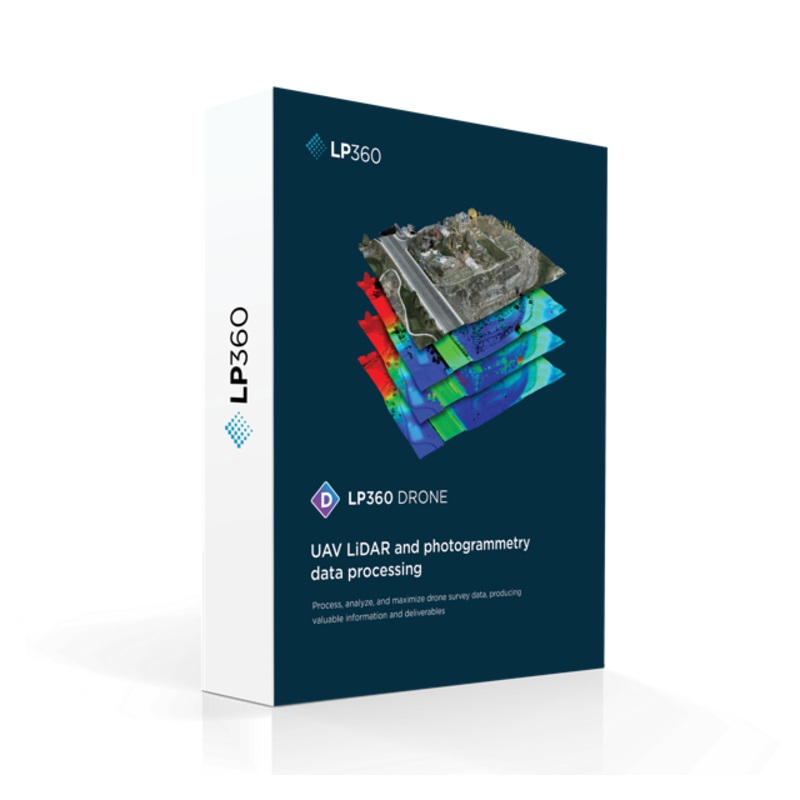
A full geospatial workflow for your LiDAR and Imagery data with visualization, QA / QC tools, Classification, 3D editing and analysis capabilities.Intuitive workflowMulti-flight import and processingGIS interface allowing combination with other geospatial
A full geospatial workflow for your LiDAR and Imagery data with visualization, QA / QC tools, Classification, 3D editing and analysis capabilities.
The new LP360 Graphical User Interface (GUI) makes it easier and more streamlined to complete your data processing and generate high-quality deliverables in an intuitive GIS environment. We have introduced Ribbons, and most importantly the ability to create your own custom ribbon and toolbar to match your specific workflow.
Its now easier to find the tools in the organized ribbon tabs:
Intelligently manage the level of detail displayed in your project. Smart technology ensures that you always have the best view of your geospatial subject possible, within LP360. Best of all, LPLAS is still backwards compatible and can be opened up in any application that opens LAS files.
When an LPLAS file is opened in LP360, you enjoy the added functionality of this optimized viewing. In addition, you can open your library of LAS files in LP360, convert them to LPLAS, and breathe new life into your old datasets with enhanced viewing!
IMPORTANT NOTE: An LPLAS file is a LAS file: Extension is *.LAS It is compatible with any software that will read an LAS file. It follows the ASPRS standard for the most up to date specification for LAS file.
Requested by many users, we now offer export to LANDXML data file format, containing civil engineering and survey measurement data commonly used in the Land Development and Transportation Industries, so you can continue your work in a CAD environment.
Seamless Data Processing Across Varied LiDAR Sources. LP360 is a powerful software suite designed to efficiently process data from any system including UAVs, airborne, and mobile platforms. Once the data is in standard LAS format or LAS + trajectory you can use an extensive geospatial toolbox to generate impressive deliverables. Supported Sensors include:


Reviews
There are no reviews yet.