Welcome to our store!

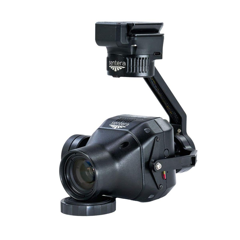
Precision Imagery for Agricultural and Environmental InsightsMaximize your drones capabilities with the Sentera 65R Payload, a groundbreaking ultra-high-resolution precision sensor designed for the IF800 and IF1200 drones.This sensor offers a ground sampli
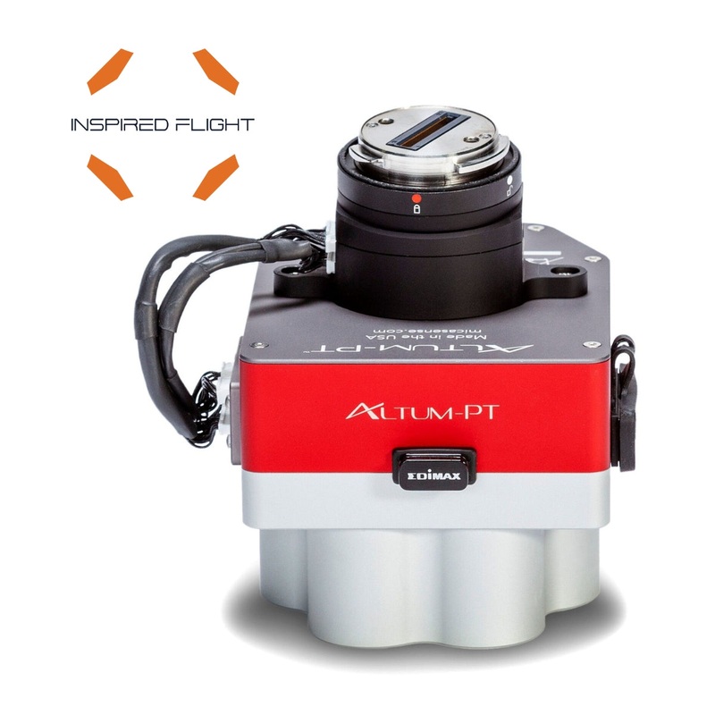
Maximize your drones capabilities with the Sentera 65R Payload, a groundbreaking ultra-high-resolution precision sensor designed for the IF800 and IF1200 drones.
This sensor offers a ground sampling distance of 0.45cm/pixel, enhancing efficiency and accuracy by capturing more pixels per image. This allows you to cover larger areas in less time, making your survey and mapping tasks significantly faster and more efficient than ever before.
The Sentera 65R is built for seamless integration with drone systems, including RTK systems, focusing on delivering ultra-high-resolution aerial images.
This integration supports critical decision-making in survey and mapping applications, ensuring you have the precise data needed for various tasks. Its compatibility with the IF800 and IF1200 drones ensures that you can rely on it for robust and accurate performance in demanding environments.
Tailored for your specific data needs, the Sentera 65R can produce RGB mosaics, detailed digital surface models (DSMs), and in-depth analytics.
Whether you are conducting surveys, modeling, or mapping, this sensor provides the high-quality data essential for your operations. With its advanced features and seamless integration, the Sentera 65R is an indispensable tool for any professional drone operator looking to enhance their aerial imaging capabilities.
Enhanced Agricultural Monitoring: The Sentera 65R offers multispectral imaging, which allows farmers to quickly understand when crops are healthy, analyze the efficiency of an irrigation system, and know the deficiencies in the nutrients or pest infestation. Therefore, this information improves decision-making and enhances yields in general.
Accurate Environmental Assessments: This Sentera 65R is efficient at carrying out accurate environmental assessments, from monitoring ecosystems to tracking deforestation through time, and to the measurement of environmental changes taking place in a specific area. Precise data collected make it indispensable for conservation efforts and land management.
Optimized Workflow Efficiency: With high-resolution, real-time imaging, Sentera 65R simplifies work flows for agricultural and environmental professionals. Since data obtained can quickly translate into actionable information, operations can be much more effective, thereby requiring fewer returns.
When you choose , you benefit from:
Resolution & Lens |
|
|---|---|
| Gipxel | GMAX3265 |
| Resolution | 9344 x 7000 |
| HFOV | 57.6 x 44.8 |
| GSD @ 38m (125 ft) | 0.45cm |
| GSD @ 120m (200 ft) | 1.43cm |
| Focal Length | 27mm |
Shutter |
|
|---|---|
| Shutter | Global |
Pixel Size |
|
|---|---|
| Pixel Size | 3.2um |
Dimensions |
|
|---|---|
| Dimensions | 6.35cm x 6.3m x 10.64cm (2.50″ x 2.48″ x 4.19″) |
Weight |
|
|---|---|
| Weight | 330 grams (including lens) |
Power |
|
|---|---|
| Power | 9-26V Input, 12W Typical |
Frame Rate |
|
|---|---|
| Frame Rate | 3 fps |
Image Format |
|
|---|---|
| Image Format | JPEG |
Storage |
|
|---|---|
| Storage | 512 GB Internal PCIe NVMe |
Interfaces |
|
|---|---|
| USB-C | USB-C |
| Gigabit Ethernet | Gigabit Ethernet |
| UART | Digital I/O Input Pulse/PWM for Image Capture Input Pulse Per Second (PPS) for Time/Position Sync Output Pulse for Image Exposure Sync |
Features |
|
|---|---|
| Features | Integrated IMU Pushbutton Trigger Option |
Reviews
There are no reviews yet.