Welcome to our store!

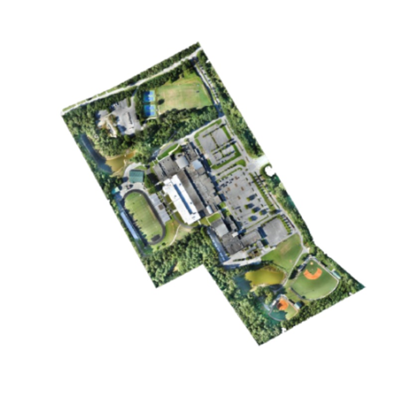
Metashape generates high-resolution, georeferenced orthophotos (up to 5 cm accuracy with ground control points) and exceptionally detailed digital elevation models/textured polygonal models. The fully automated workflow enables a non-specialist to process
Metashape generates high-resolution, georeferenced orthophotos (up to 5 cm accuracy with ground control points) and exceptionally detailed digital elevation models/textured polygonal models. The fully automated workflow enables a non-specialist to process thousands of aerial images on a desktop computer to produce professional-class photogrammetric data.


Reviews
There are no reviews yet.