Welcome to our store!

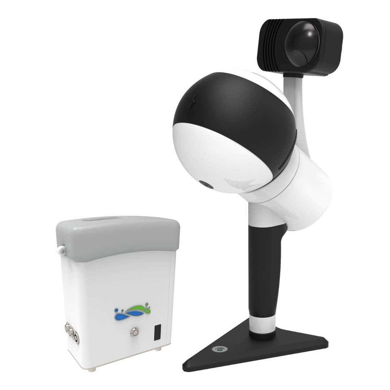
Efficient mapping workflow with LiGrip H300Introducing the GreenValley International LiGrip H300 Rotating Handheld SLAM LiDAR System, the ultimate tool for rapid and accurate data collection.Unparalleled precision and speedThe LiGrip H300 incorporates adva
Introducing the GreenValley International LiGrip H300 Rotating Handheld SLAM LiDAR System, the ultimate tool for rapid and accurate data collection.
The LiGrip H300 incorporates advanced SLAM technologies, enabling rapid acquisition of high-precision point cloud data with absolute coordinates.
When integrated with LiDAR 360 and LiDAR 360MLS software, this comprehensive solution streamlines mapping, mining, forestry, road infrastructure assessment, and other geospatial applications.
Unlock the full potential of your mapping projects with the GreenValley International LiGrip H300. Experience the power of cutting-edge technology in the palm of your hand.
Reviews
There are no reviews yet.